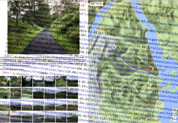
I occasionally make simple mashup of of gpx, google maps and flickr photos of walks. I record gpx on the Trails app on my phone, take photos with the phone too as they are nicely geo tagged and flickr can use that information and provide in the API 1.…
Tag Archives: maps
Creating a new journey map. Connecting Chicago to World.
I started hosting Tutor/Mentor Leadership and Networking Conferences in Chicago in May, 1994, as part of a strategy intended to draw area volunteer-based tutoring, mentoring and learning programs and supporters together to learn from each other and as part of a strategy to increase public awareness of tutor/mentor programs all over the Chicago region, so that more would have the talent and dollars needed to sustain their work and constantly improve.…
Loch Oss & Ben Oss
I am testing the WP-OSM-Plugin I was hoping that the map would show the photos on markers as well as the GPX track I’ve uploaded. There is an example: EXIF-Test-page | WordPress OpenStreetMap Plugin
The shortcode I am using looks ok to me and the photos are geotagged.…
DT in the Latin Classroom
Now that I’ve working more with design thinking and have learned how powerful of a mindset it can be for creativity and innovation, I’ve been trying to infuse it into my Latin classrooms. It’s not always easy to move through the entire design thinking process in a Latin course, but I believe it can be done—and done well—in at least a few ways.…
MOOCs "Not a Course. It’s a Collaboration"
Terry Elliot, one of the participants in the Making Learning Connected MOOC #CLMOOC that started a couple of weeks ago posted an article today showing some of the people he’s connected with, including me. In the article he included a line saying “This is not a course, it is a collaboration.”…
Mapping Chicago Violence. Engaging Community.
Today’s Chicago Tribune devoted the front page and two full inside pages on a story showing the impact of shootings in Chicago. Included was an interactive map at http://chicagotribune.com/shootings that you can click on to understand the number of people shot in Chicago in the first six months of 2013 – 1,043.…
Maps
Maps! I have a lot of maps in my car, stuck into the pockets of the door. Maps of states and provinces, maps of attractions, museums, historic sites, maps of army bases. Some of the maps are in map books, some on the large sheets of paper that you try to fold back into the proper shape after using but never quite succeed.…
Chicago, Global Network Building
I’ve been participating in the Making Learning Connected MOOC this week (#CLMOOC)and the topic has been mapping. As a result of a suggestion I made over the past weekend a Google map has been launched that participants can add their name to.…
Google Earth/Maps Latin Project
Thanks to inspiration from the Power Searching with Google course, I developed a digital Classical scavenger hunt for our last JCL club meeting of the year that takes advantage of Google’s search-by-image feature. The experiment went well, and I’m looking forward to integrating the the use of images and Google Forms into my Latin classes next year.…
Mapping a Network
Recently, I asked all of you a question, “What would you do as a Director of Blended Learning?”
Immediately after the first response came in, I realized that I would need some way to aggregate all of the answers.…